Performance
Takeoff
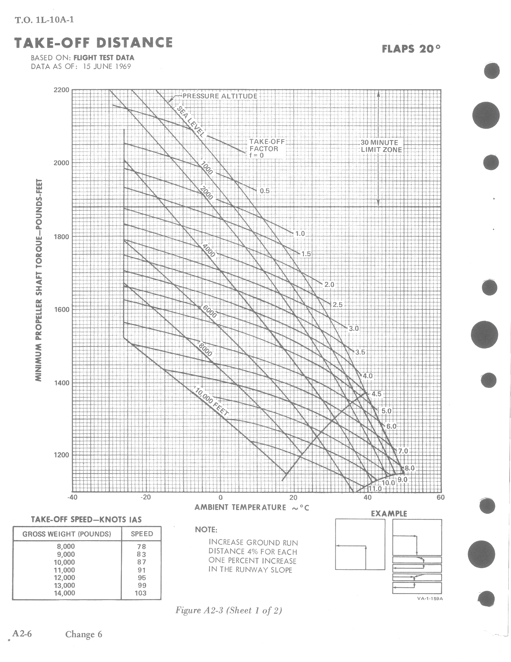
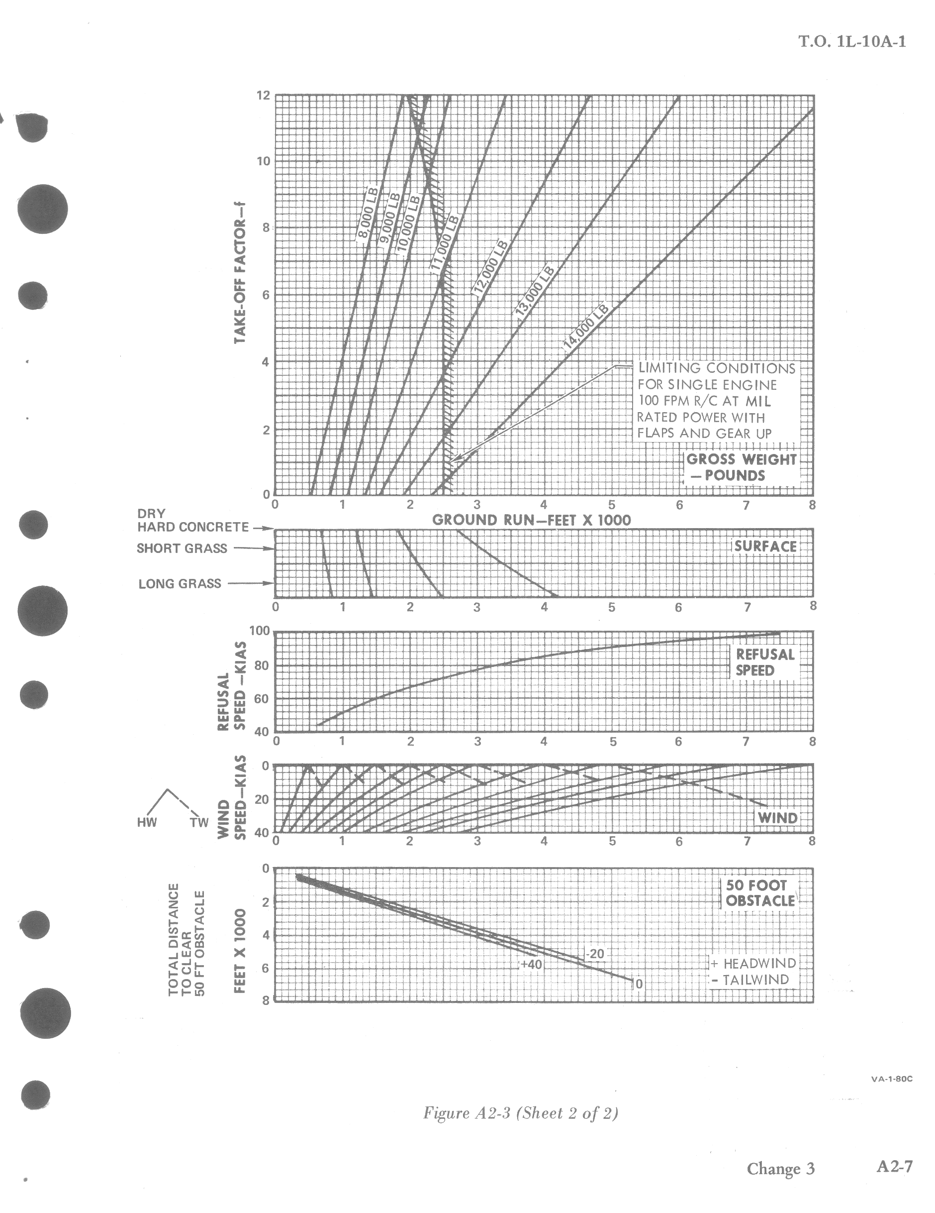
The take-off distance charts provide a means of determining take-off distance under normal or STOL operating conditions, with 20 degrees of flaps. The charts present expected torque, refusal speeds, take-off speeds, ground run distance for various types of runways, with various wind conditions.
These data are based on two-engine operation as a function of aircraft weight.
Takeoff distance includes horizontal distance required to take-off plus climb to a 50 feet clearance height.
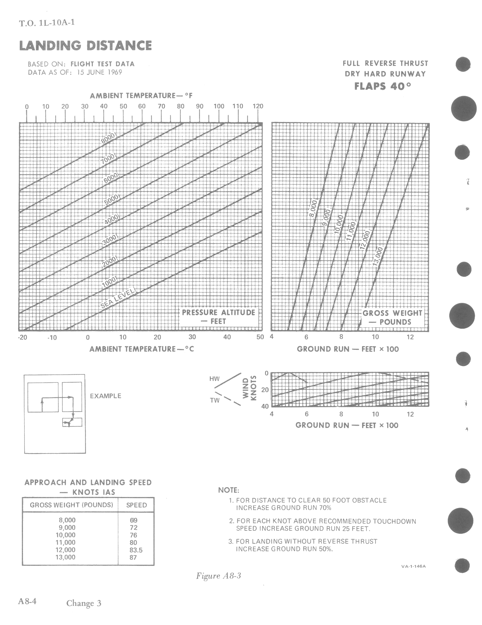
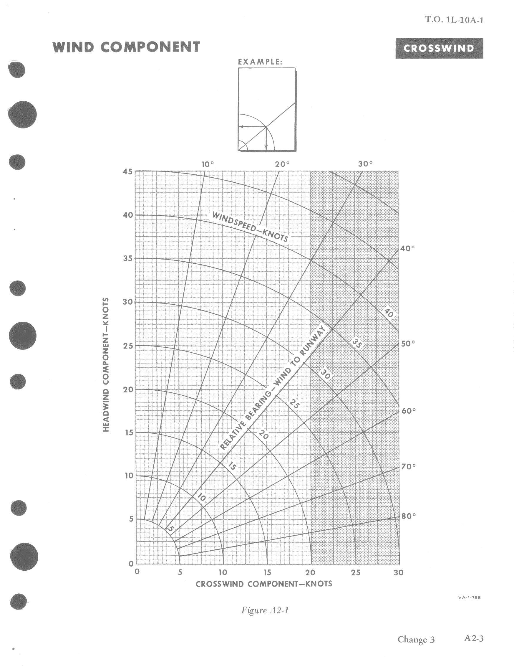
A wind component chart is used to obtain headwind, tailwind, or crosswind components for winds from 0 to 60 knots at angles up to 90 degrees from aircraft heading. Crosswind component limit is 20 knots for take-off and landing.
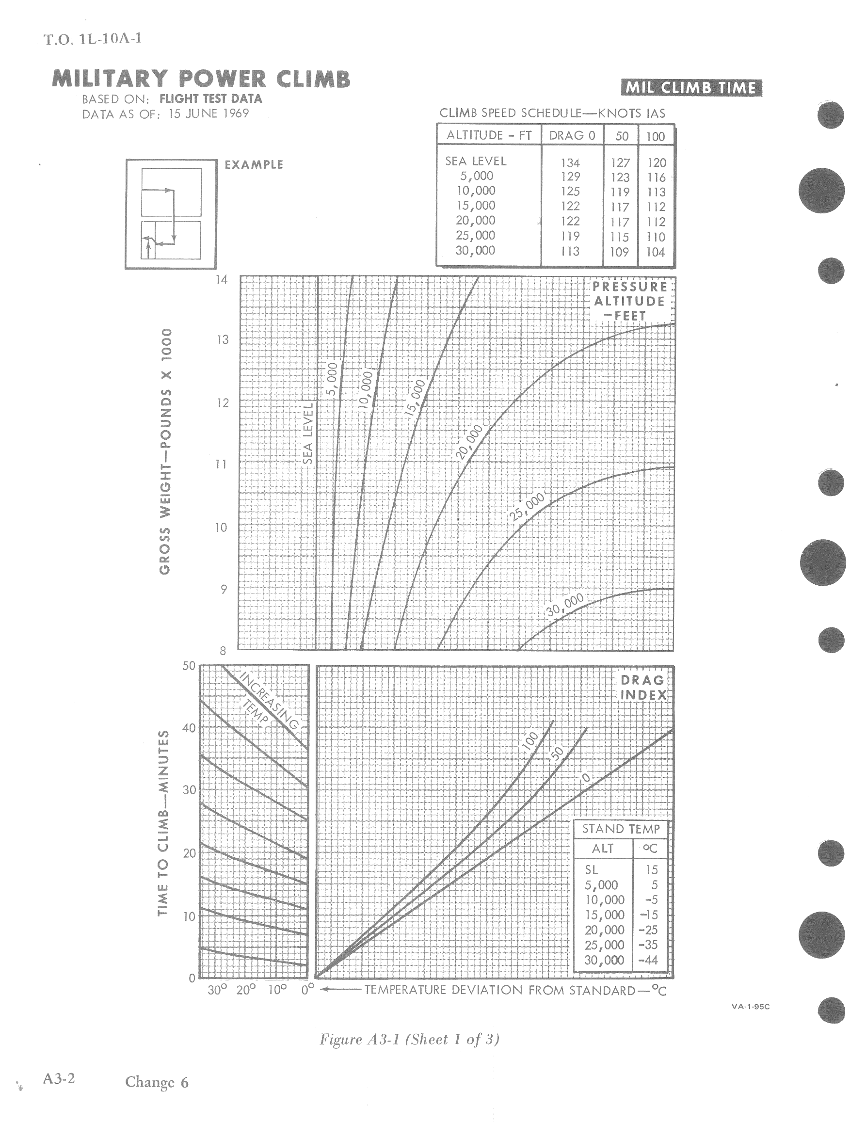
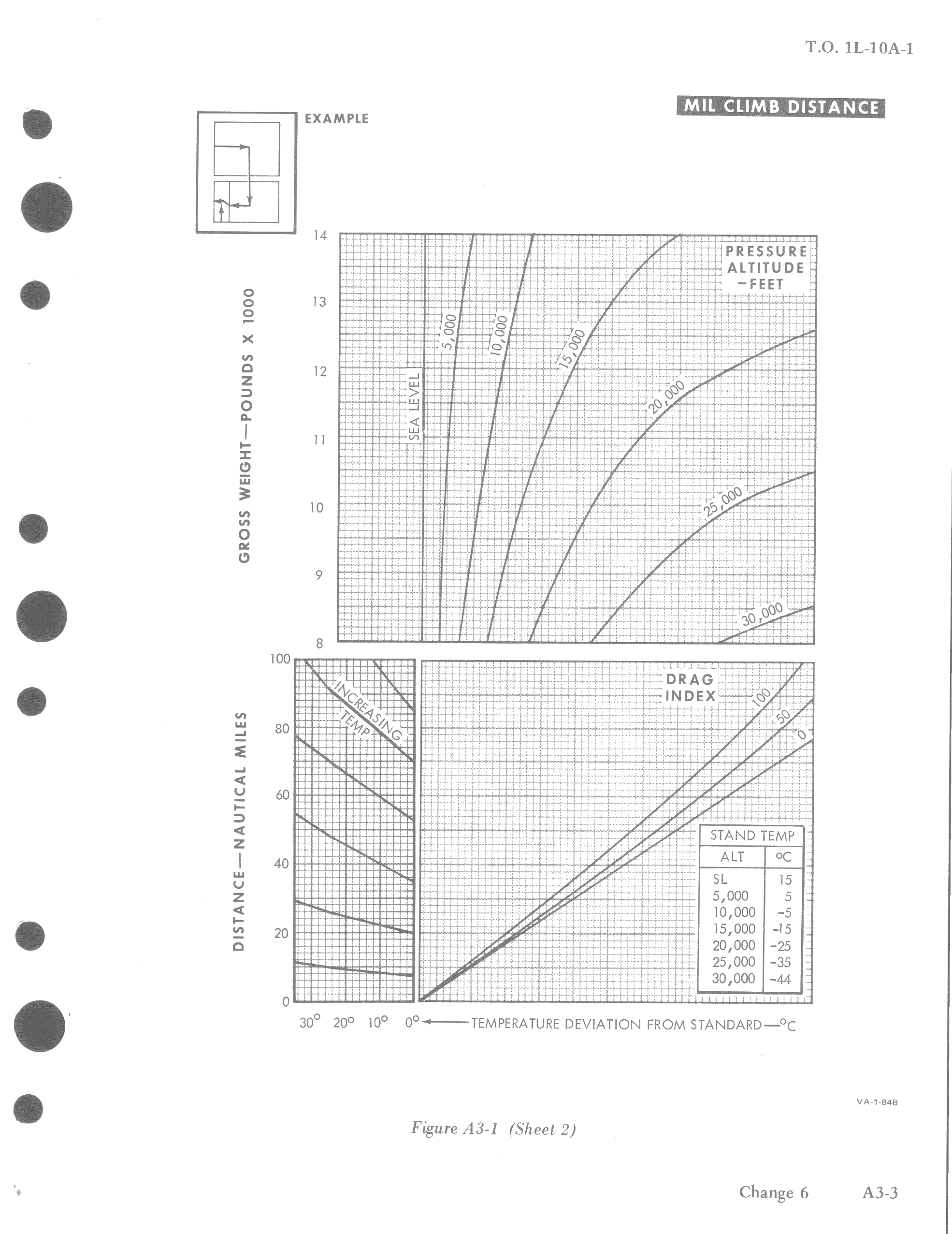
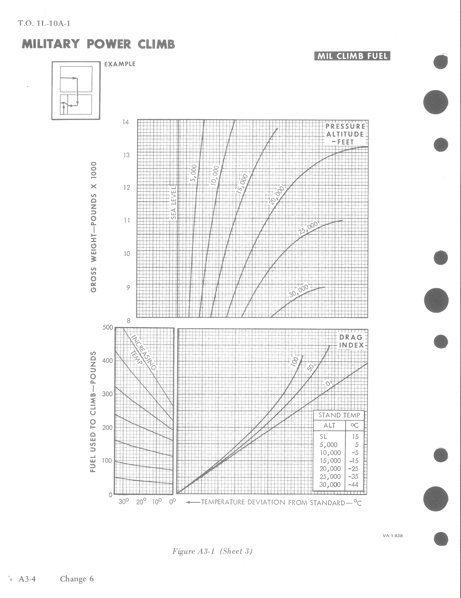
Climb
Those three charts show time to climb, distance covered and fuel required at best climb speed with Military power at various gross weights, drag indexes and ambient temperatures.
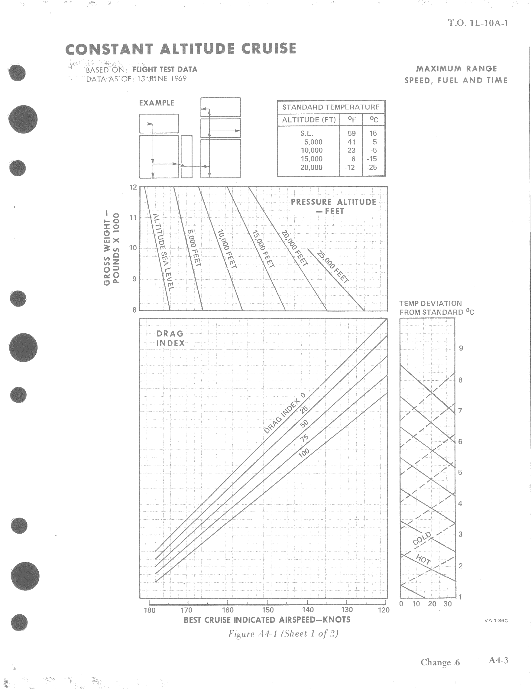
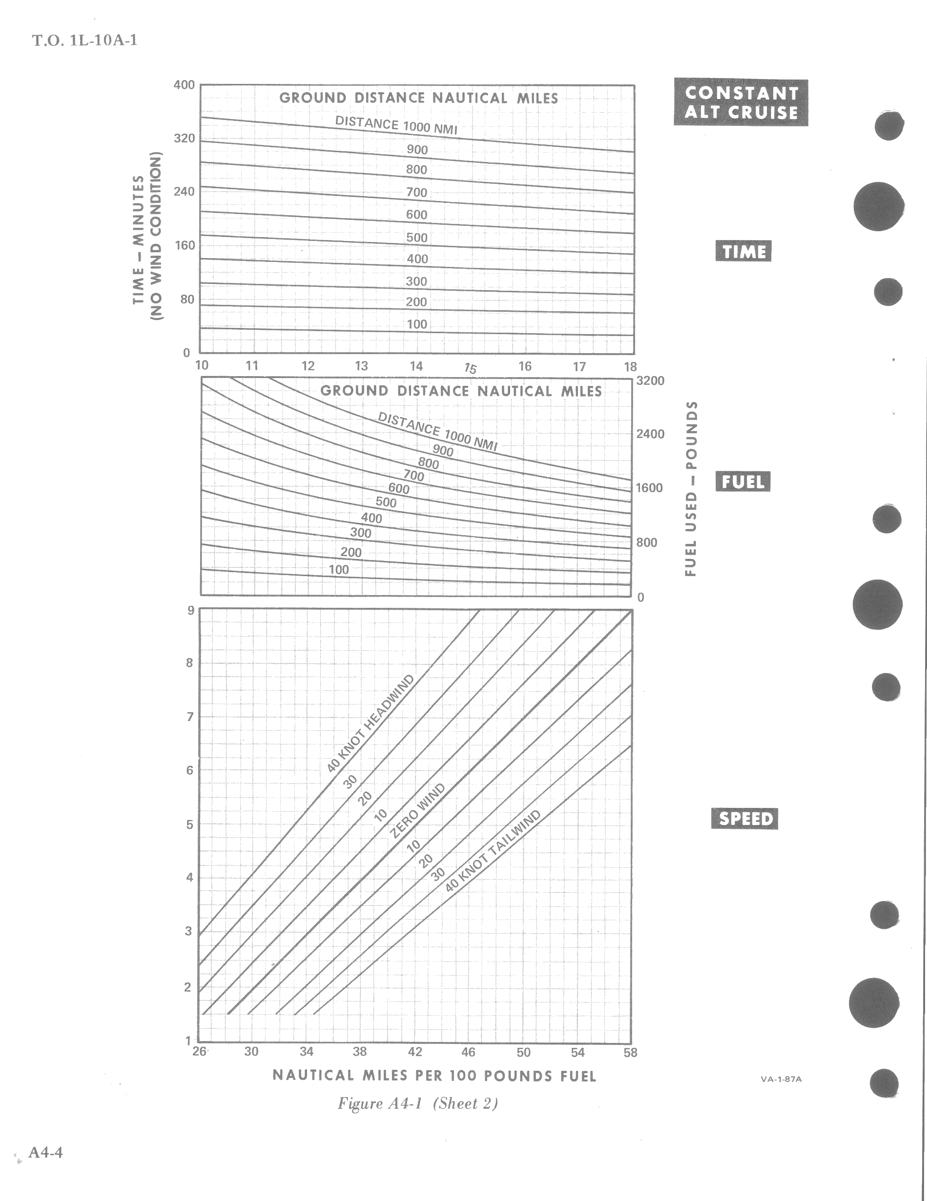
Cruise
Constant altitude cruise charts are used to determine speeds, fuel and time requirements for navigational flights. An average gross weight may be used for a given leg.
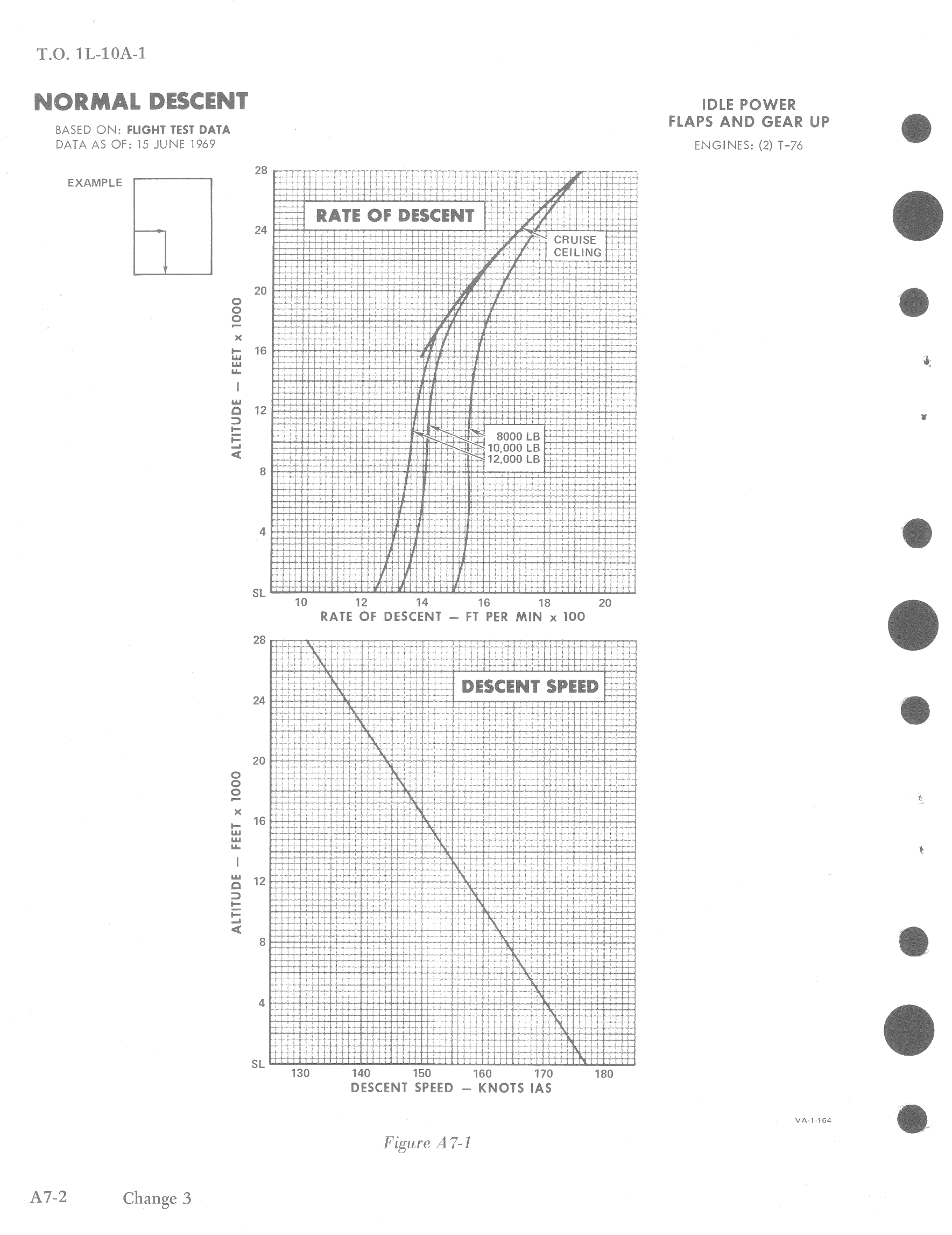
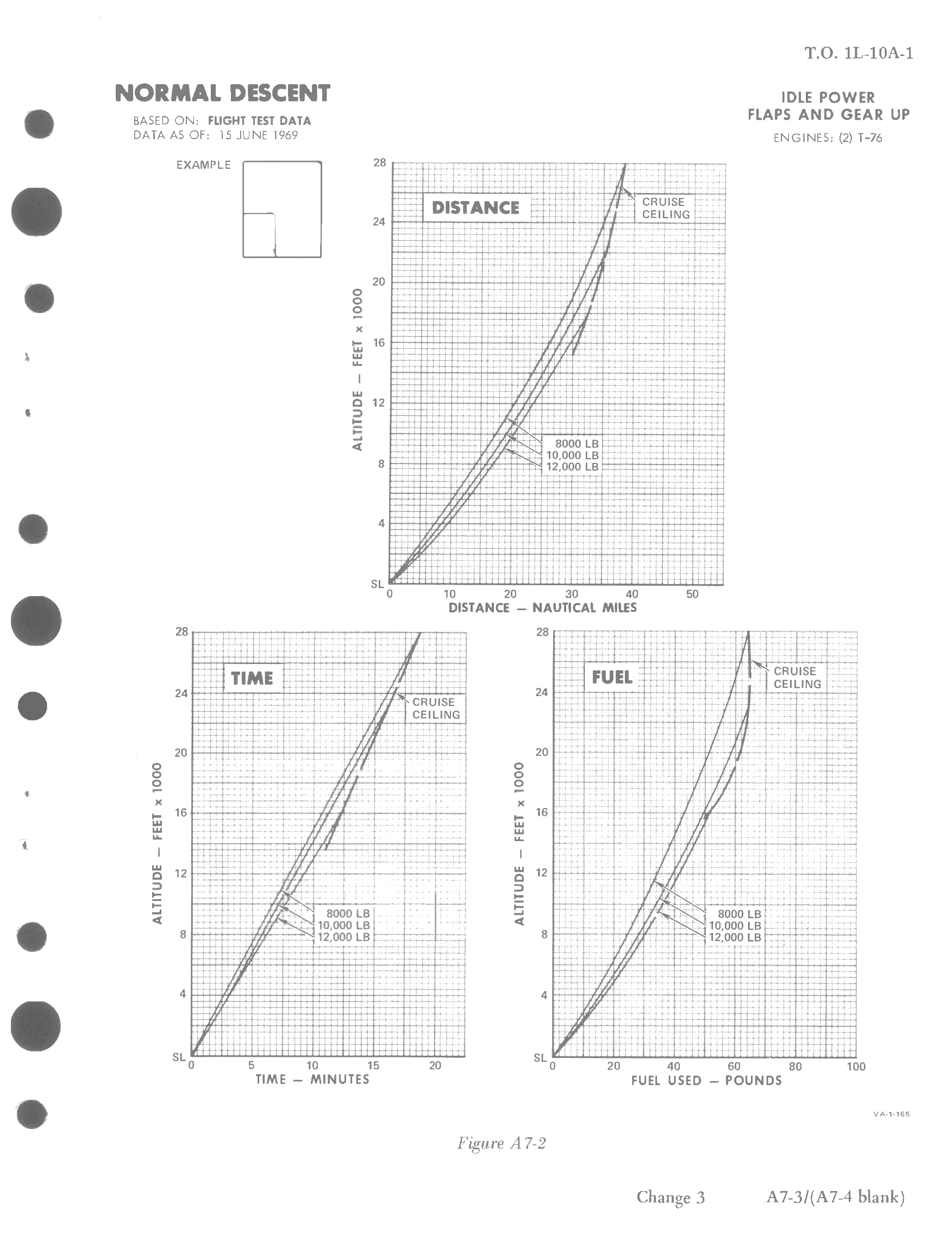
Descent
Descent data depicts the maximum nautical miles per pound of fuel obtainable during operational descents from altitude down to the landing pattern or target area. Rate of descend and descent speed during a normal descent are determined with both engines at idle power.
Landing
Landing distance chart determines landing roll for normal performance on hard surface runways for 40° flaps setting, with full reverse thrust.