HSI
Description
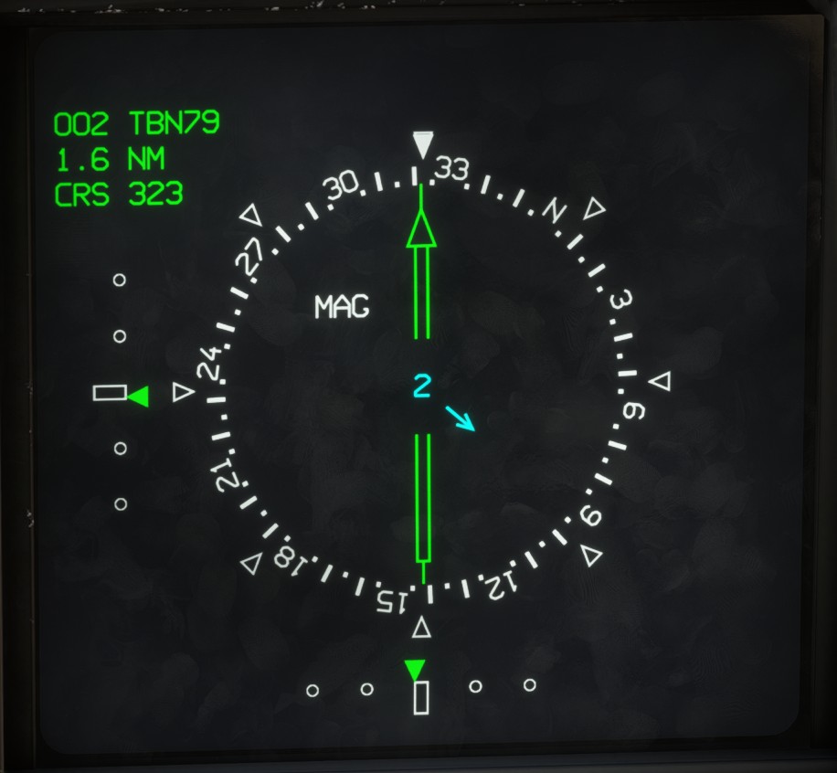
The horizontal situation indicator is the aircraft's primary navigation display.
It can be accessed using the RLD Page Selection Switch or assigned to a lateral display from the LD DAS page.
The page is divided vertically into two sections. The left section displays information related to the primary goal, while the right section displays information related to the secondary goal.
The compass rose indicates the aircraft heading, using either a true or magnetic reference depending on the selected heading mode. Reference markers are displayed every 45 degrees.
The lower section displays the aircraft's ground speed and fuel consumption per nautical mile flown, expressed in kilograms per nautical mile.
The center of the compass rose displays the calculated wind direction and speed in knots.
Primary goal
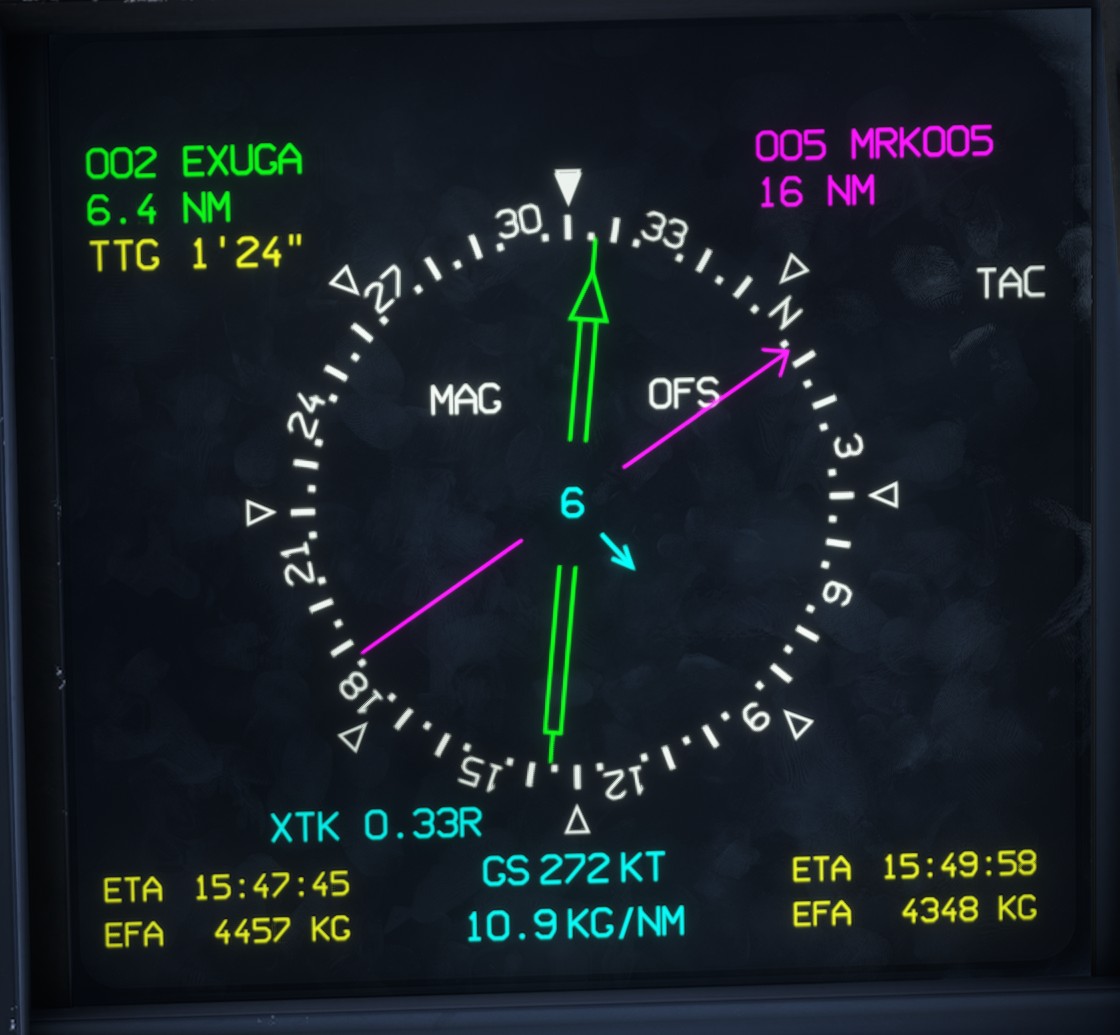
The primary goal is displayed in green, together with its database number, name and current distance from the aircraft.
The double green needle points towards the primary goal.
TTG displays the estimated time to the goal in minutes and seconds, calculated using the current ground speed.
XTK indicates the cross-track deviation from the active flight plan route. In the example above, XTK 0.33R indicates that the aircraft is 0.33 nm to the right (R) of the route.
The lower section displays:
ETA: estimated time of arrival.EFA: estimated fuel remaining on arrival.
Secondary goal
The secondary goal is displayed in magenta.
When no secondary goal is selected, all associated fields are dashed.
Click the secondary goal field and use the visualization knob to select any available goal from the database.

Once a secondary goal has been selected, the following information is displayed:
- Database number and name.
- Distance in nautical miles.
- Estimated time of arrival.
- Estimated fuel remaining on arrival.
The single magenta needle points towards the secondary goal.
MAG/TRUE setting
The HSI page is used to switch between true and magnetic heading references.
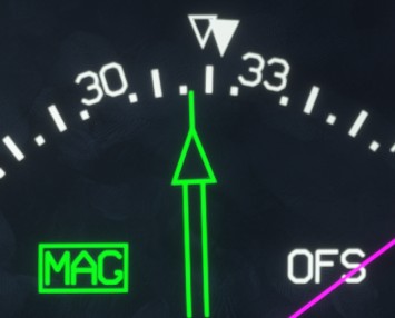
Select MAG to use magnetic headings. When magnetic mode is active, the label is displayed in green with a green outline.
This setting affects the heading indications shown on the HUD, HCD and both lateral displays. The IPS always displays magnetic heading, regardless of this setting.
The angular difference between the filled triangle and the outlined triangle represents the local magnetic variation.
TACAN
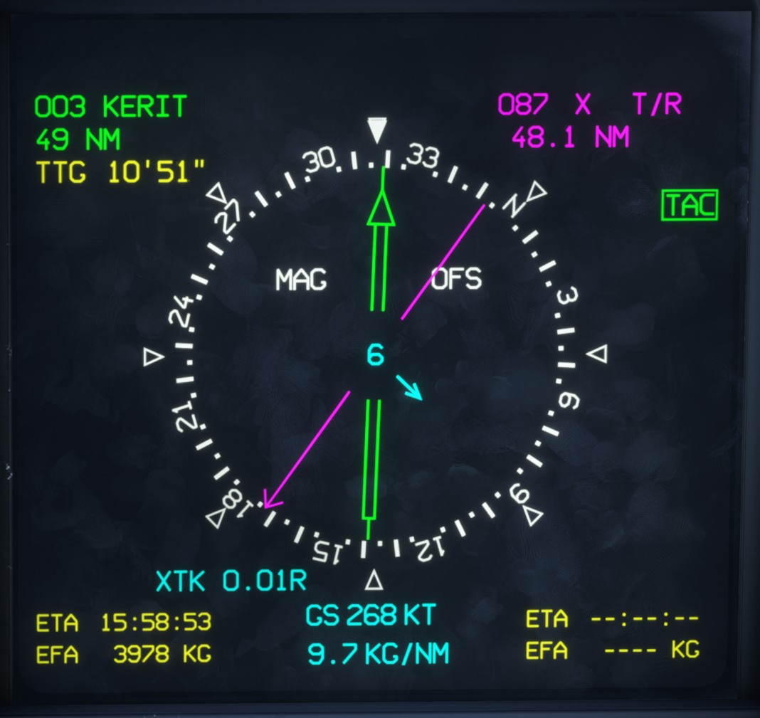
The secondary-goal section can be switched to TACAN mode by selecting TAC. When TACAN mode is active, the label is displayed in green with a green outline.
The TACAN settings can then be adjusted using the vizualisation knob:
- Station channel (1 to 127).
- Channel mode (
XorY). - TACAN operating mode:
T/R: transmit and receive, providing both bearing and distance information.R: receive only, providing bearing information without station distance.A/A: air-to-air TACAN mode, which is not supported in MSFS.
When a valid TACAN signal is received, the distance to the station is displayed and the magenta needle indicates the bearing to the station.
ETA and EFA are dashed in TACAN mode, as these values are not calculated for TACAN stations.
The Rafale HSI does not support tuning VOR stations. Only TACAN navigation is available.
Offset
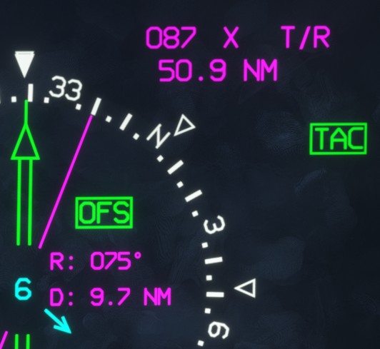
The OFS function allows a virtual navigation point to be defined at a specified bearing and distance from a TACAN station.
Select OFS to enable the function. When active, the label is displayed in green with a green outline.
The offset bearing (R) and distance (D) can then be adjusted using the vizualisation knob.
The magenta needle points towards the resulting virtual point, and the displayed distance takes the selected offset into account.
ILS display
When a valid ILS approach is configured and the aircraft enters the approach phase, the HSI display changes to provide dedicated ILS guidance.
The primary and secondary goal information is replaced by horizontal and vertical deviation indicators.
CRS displays the runway course in degrees.